Sunday, June 29, 2008

First leg complete; with the family now


I made it to my aunt and uncle's cabin near Burgess Junction Saturday in the afternoon and will be here for a few days, happily disconnected from cell service. I have some pretty limited time with the net right now and need to focus on my route up to North Dakota and across it so this post will be quick.

Granite Pass (9000') was long, but not too difficult. Shell Canyon at the beginning of that climb was gorgeous, and if you're ever down that way, be sure to have a meal at Dirty Annie's before you start the ascent.

When I arrived at the cabin, there were 18 relatives there waiting at the gate to meet me--a pretty exciting moment I'd been pedaling somewhere in the range of 1700 miles to get to. Attached is a photo of my dad and I sitting on the old jeep seat at Riley's Point. We've been 4-wheeling, hiking, and trout fishing, eating and laughing together, and my laundry is all hanging on the line to dry. As my host and uncle Stan put it, it's great to be around my folks when they're 1000 miles away from home, in a beautiful setting just enjoying themselves. Being together in a place like this encourages people to talk about things they haven't talked about in years and really remember the great parts about being family. I'm learning a lot this long great weekend about people I thought I already knew by heart.


Friday, June 27, 2008

Flying along

111 miles yesterday to Cody and 86 today, the last 10 of which have
been steady switchback climbing. Plus, I'm only halfway up this climb
to Granite Pass (9300'), which will be my highest yet.


Yesterday I really had to blow past a lot of incredible things in
Yellowstone, but this family get-together in Burgess Junction is a
much more unique opportunity. I basically entered at the south gate,
hooked around West Thumb Lake, and shot out the east entrance. Old
Faithful was not involved. I'm definitely going back to Yellowstone,
but would like to time my exploration to a quieter time in the park.


The ups and downs over the last two days have been wild. I was above
8000' at some points in Yellowstone, down to 3800' in Greybul for a
root beer float this afternoon, and tomorrow mid-morning I'll hit that
9300' pass.

Thursday, June 26, 2008

Tearing through Yellowstone

From Jackson through the Tetons and on into the South Entrance of
Yellowstone yesterday. Of course, I didn't leave Jackson until the
afternoon, but I still put on 71 miles before (well, sort of) dark. I
camped at beautiful Lewis Lake Campground, which, of course, was
closed--probably because there was still too much snow on the ground.
I camped at my first "this site reserved for hikers and bicyclists"
campsite, which made me smile. A bit of rain around 1 AM woke me up
quick to put on the rain fly (I swear I had a sky full of stars at 11
when I fell asleep...), amidst an otherwise peaceful night.


Due to some...less than helpful terrain recommendations ("yup, it's
pretty much flat from here") I didn't get to camp until late. Just
after the sun went down, I crested a 6-mile climb and found myself all
alone with a big bison on the narrow, no shoulder road. He was
trotting along the same direction as me in the right hand lane. Afraid
of spooking him, I swung wide into the left lane and slowed way down.
As I passed him, he turned his long head, from horns to that big
grandpa beard they seem to have, looked at me and huffed lightly. I was
amazed, and decided it was most wise to skip out on the photo op just
this time.


I also got to test out my new binoculars to spot a female grizzly bear
lumbering along from mid distance.


Today I'm shooting for Cody, which will put me at an ambitious 110
miles for the day. I'm optimistic, but we'll just have to see as the
day goes on.

Wednesday, June 25, 2008

On through Yellowstone after a good day's rest


Well, I made it over Teton Pass without trouble Monday afternoon and spent all of yesterday relaxing and running some errands here in Jackson, Wyoming (bug spray, toothpaste, and sunscreen all needed replenishing). I'm very lucky to have Katie (a native of Jackson, pictured here) as a longtime friend. Getting to spend time with her and the rest of her family was such a treat. Just think--a real bed in a real home and a real home-cooked meal. Thanks especially to Betsy for the French toast, Hugh for the talks about routes and roads, busy Andrew for our quick morning chats, and Katie for our good catch-up talks and help with everything around town (and for taking me out to Teton Thai, a very fun restaurant I recommend to anyone in Jackson for a warm evening).

Now I'm ready to go the 280 miles from here to Burgess Junction to meet up with a whole slew of family from Iowa who will be there this weekend. This week is going to be 3 big days of riding followed by a few days off.

I did find a good pair of compact 8 X 25 binoculars while I was in town and look forward to using them on today's ride through Grand Teton National Park and Yellowstone National Park. Because of the family reunion and the timing of everything, I'll pretty much have to cruise on through these places without too much exploring. Luckily, at 12 mph, I don't miss much of my surroundings. I've never been through here before, and I'm definitely coming back to this area to linger in the future. Like many of the places I've passed through thus far, my experience reads like an invitation to come back.

A quick note about my photos on flickr: I think lots of things are out of order and there may be duplicates, etc. That'll probably be that way until I get to my hometown of Decorah in Iowa and have some solid time to "relax" in front of a computer. If you're interested in flipping through what's there, click the photo in the slideshow on the right side of this page and browse around.

Yesterday marks 3 weeks on the road and I believe that during today's ride I'll hit a cumulative total of 1500 miles. I'm getting pretty excited to meet up with family Friday evening and will likely stay there through Monday or Tuesday nestled in the Bighorn Mountains. It will be great to have enough time out of the saddle to do a good chunk of hiking, catching up with family (at least a dozen folks will be there, I imagine, including my parents, aunts, uncles, cousins, one of my brothers along with his wife and kids), and some genuine loving-care bicycle maintenance. Oh yes, I will have that drive train sparkling silver and may even true the wheels up a little.

Sunday, June 22, 2008

Final night in Idaho

The photo here is from breakfast this morning. I'm keeping this short
as tomorrow is a big day and I need my rest: 80 miles to my day out of
the saddle in Jackson and Teton Pass is between here and there. I
think the road goes up to 8700 feet...something like that, which will
be my biggest summit yet.

Saturday, June 21, 2008

Rodeo Serendipity

Today started out as a real challenge. Uphill and into the wind for 8
miles to another 7000-something foot summit. There was an Idaho DOT
weather station at the top and those aenenometer cups were spinning
like mad.


After cresting, it was a mostly smooth 30 miles into Mackay
(pronounced MACK-ee) where I happened upon the tail end of a town
parade and after a little asking around discovered that there was a
rodeo later in the afternoon. That settled that and I headed to the
Miner Hill Grill to grab a hot sandwich while the rodeo got set up.


FYI--they serve fry sauce in Idaho. ...and here I thought that was a
phenomenon exclusive to Utah.


I saw calf roping, barrel racing, whatever-you-call-it-when-they-ride-
those-bucking-horses, team roping, and bullriding.


I ended up stopping for the night in Arco, which was the first town in
America to be powered by nuclear energy. Their summer festival is
Atomic Days, which is next month. My legs had more miles in them, but
between here and Idaho Falls is 60-some miles of desert with no
services save a highway rest stop that one out of three locals polled
claims has drinking water. Heading strait east in the morning I
shouldn't have trouble getting through there but I really didn't feel
like attempting it today after all that rodeo business.


This whole trip through the great west I'm becoming more and more
interested in birds--what they find to eat, what they're saying to
each other, which activities are cooperative and which ones are just
every bird for themself. I think I might hunt a little for some
binoculars in Jackson when I get there (hopefully Monday).


Also: any birders who've been messing with the iPhone SDK, let's make
something really good...collaborate with the Audubon Society...the
whole deal. I think there's a really fantastic mobile application
waiting to be developed there...search for colors and characteristics
based on geolocation, add your own date/location/photos to a species
record. Someone will develop this application, I just have a suspicion
that it won't be of the highest quality because there likely wouldn't
be substantive financial reward as motivation.

Friday, June 20, 2008

Camping out

Stanley was so beautiful and relaxed that I (of course) didn't leave
until well after noon. The late start didn't slow me down along the
very pretty winding road that followed the Salmon River 57 miles to
Challis. I was even spinning my big chainring for a good chunk of
time--something I really rarely do with a touring load. After stopping
there for dinner, I rode another 20 miles southeast of town along US
93 en route to Arco.


So here I am, camped out in nowhere, Idaho and there's some howling in
the distance. The overnight low's supposed to be somewhere in the mild
low 40s. I can hear a car pass by every few minutes but have situated
myself so as not to see them. I generally don't like to camp where I'm
not able to let someone know where I am (mostly to avoid anyone
thinking that I'm somehow trying to be sneaky) but there's really no
one to check with in these parts.


Ok, so the howling sounded like a coyote, sure, but these other
sounds...they are indecypherable to me. Probably some insane bird that
hopefully likes to sleep when I do. The photo here is the view from
inside my tent.

Bluegrass, hot springs, Sawtooth Range

The fiddle contest and festival in Weiser was so much fun. Many thanks
to my Oregon desert friends Bob, Tim, and Lori for convincing me to
head on up there. The contest is one thing, judged and orderly inside
the high school. The fiddlers range through all ages from 9 to 90 I'd
imagine, and I heard one 9-year-old girl play a waltz prettier than
anything I'd heard in a good long while.


The rest of the fest is a disorderly confluence of fiddles, banjos,
mandolins, and guitars, huddled around tents and RVs who've come from
all over the west. The event's been happening since the 1950s and a
lot of folks come back year after year to get together with ILS
friends to play impromptu oldtime, bluegrass, or Texas swing in the
main camping field or off in Stickerville (so named for the goatheads
and stickers that used to end up on everybody's shoes). Thanks very
much to my new friends Barry and Jen for showing me around and
introducing me to Tim, champion fiddler John, farmer Ed with the huge
voice and so many others.


The next day, after unwittingly staying up till 2 in the morning
sitting around jam sessions, I pedaled 94 miles to camp at some hot
springs east of Garden Valley, ID, which really was a good reason to
linger through yesterday morning. I sat in a natural hot tub, so to
speak, overlooking the Payette River rushing down below. A lot of
rafting trips head through here and there were some serious looking
rapids that I'd imagine only the most daring river rats would attempt.


Yesterday, I climbed and climbed (and climbed) up to the 7200 foot
Banner Summit and here I sit in a nice little coffee place in the
little resort/hunting/rafting town of Stanley. The Sawtooth Mountains,
pictured here, are gorgeous. Today I'll be riding through them along
the Salmon River.

Monday, June 16, 2008

120 miles through the desert; day of rest


Like I said in my previous post, it was 120 miles through the desert to Burns, OR and I'm happy to say I made it. When I got to the town of Valley Falls (consisting of one closed-down store, 3 houses, and 2 RVs) I was lucky to see the man who runs Oregon Desert Brine Shrimp outside his shed who let me fill up my water bottles before heading out into the most remote country I've seen yet. I didn't catch his name, but he lives in Portland most of the year but comes out to Lake Abert (an alkali lake, like the Great Salt Lake in Utah) every summer for the last 25+ years and scoops out brine shrimp while sitting in a small raft, takes them back to his shed to bag them up, and spends the rest of the year marketing and selling the wares. A really interesting guy with a really interesting way of making a living--inspiring. If you browse through my flickr page and think "who's the guy with those big trays of reddish-brown stuff?" --that's him. If you ever see this, thanks, friend, for the water.


The first 50 miles were beautiful. There's a rim of rock rising 2000 feet straight out of the ground along Lake Abert for miles, and the bird life is incredible for how harsh the terrain is. Giant boulders line the roadside and there's no traffic. There's a wayside rest area with a drinking fountain and a picknick table maybe 15 miles after the lake where I met up with three kind souls who offered me a fresh carrot and some wild Davis, CA plums on their way to the fiddle festival in Weiser, OR. I'm hoping to go a little out of my way on Tuesday or Wednesday to end up there and maybe meet up with them among the throngs of oldtime musicians.

The second 50 miles were brutal. FYI for any cyclists heading through: at press time, the store in Wagontire is no more, so bring and extra extra bottle to fill up at that wayside station. Also, Alkali Lake Station is just a highway maintainence yard, not a town.

Once I got to Riley, I still had 26 miles to go for Burns, but was able to fill up (and drink, and fill up again) my bottles and have a snack at the store there. Riley, as I learned, is a store and an RV. That's all.

In Burns, I took all of Sunday off for some good walking around ("Obsidian Days" which turned out to just be a travelling sales event for the rock hunter/RV set), napping, mapping, and mechanical maintainence. I feel ready to hit the road in the morning on Monday.

Oh! Good news. My friend DJ had time to upload the shots from my official pre-trip "photo shoot." Here's a photo and a link to the rest.


My body's in great riding shape now and after today's rest I'm ready to really start rolling down the road. For my family who'll be in Sheridan, WY at the end of the month, I ought to make it there just in time. Thanks to all my friends and family who've commented or emailed or SMS'd or called while I'm travelling. It's always nice to hear from familiar voices.

Friday, June 13, 2008

Oregon!

That Bieber Motel was a great place to stay. The dinner I had in that
town ( at Moe's Pizza) was great, as was the breakfast at Kathy's the
next morning.


Thursday, I rode the 54 miles to Alturas and stayed in another $40
motel--I'm getting soft, I know. My rationalle, while sucking down a
peanut butter chocolate shake at The Munchbox, was that the 300 miles
of southeastern Oregon I was about to enter is pretty remote, and I
oughtta be around people while I can.


Friday, when I finally got on the road around 12:30 (after one more
Munchbox peanut butter chocolate shake, I absolutely flew down the
road. I'm camped out now in Oregon, about 20 miles north of Lakeview.


Just before crossing the border, I stopped into a wild plum winery and
tried some samples while talking with the owner. I ended up taking a
jar of wild plum jam along with me which I'm thinking is going to make
a nice breakfast.


Mmph, there are lots of other stories, and I'm noting that my
"writing" is a little bland. This one-thumbed typing is tiresome.


Tomorrow (Saturday) I'm going big and banking on some more winds from
the south. I'd like to get all the way to Burns, some 120 miles away,
though I'd settle for...um...anywhere with dinner. If you look at
Highway 395 on an Oregon map you'll see that there's not much out here
in the way of towns or services.

Wednesday, June 11, 2008

Down from the mountain

Tonight I'm in hay and alfalfa country after a good 70 miles out of
Lassen Park. There's a motel here in Bieber (just north of Nubieber)
that charges $40.75 per night tax included. There's free coffee here
so as far as I'm concerned I'm making money on the deal.


Tomorrow I'll near the Oregon border after getting through Alturus

Tuesday, June 10, 2008

Lassen peaks

Yesterday at noon I was at an elevation of about 200 feet in Chico.
Today around 6 pm I was starting my descent from 8500 feet, the
highest point along the Lassen Park Road.


At the top, there were frozen lakes and snowfields. The way down was
so cold I had wool socks on over my gloves and wore a kind of
wrestler's mask under my helmet. Frank and Nicole, I feel like you
gave me that mask thing for my birthday...well, it's coming in handy
against all odds.


Big thanks to Alex & family at the summit today for filling my water
bottles--I made it to Lake Manzania.


Ahh, PB&J under a flashlight, what a nice bedtime snack.

Late start, beautiful finish

The photo here was taken along the Deer Creek Trail in Lassen National
Forest. Hats off to the local USFS for maintaining a really nice
trail, with frequent numbered (yet unobtrusive) signposts.


I didn't get rolling out of Chico until around noon yesterday, and had
to climb out of the valley for, I kid you not, about 18 miles
straight. Good riding, though, as the grades were all reasonable.


Last night was the first time I've slung my food up in a tree in case
of bears, and miraculously I was succesful without too many "antics"
which would have only been funny years in the future. I didn't get it
all that high up, so probably only the most curteous bear would have
passed it by; still, I'm glad I did so because I believe it would be
difficult for a hungry bear to show many manners at all had my food
been with me inside my tent.


Today I'll be passing through Lassen Volcanic National Park, which I
hear has quite a dramatic landscape. I may not ride too far if it
needs more exploration.

Monday, June 9, 2008

Big hills, rice fields, sprint cars, the biggest pork chop


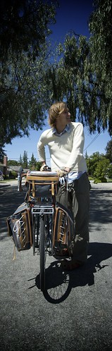
Starting out in the hills west of Williams, I packed up my gear and rode the 22 miles to town on minimal breakfast and water. Hungry, I rolled into Williams about 10 minutes before the annual town parade was to be held. On I pedaled through main street, the unassuming pre-parade curiosity. All the littlest kids on the curb and oldest citizens in lawn chairs seemed to think I was fun to see while everyone at ages in between looked mostly bewildered. I didn't stick around for the rest of the parade.

Next, in Colusa, I headed north on CA 45, straight into the brisk north wind, which incidentally was headed the opposite direction as my research had indicated would be seasonally appropriate for the area. This was alright, it just meant I'd be going 12 mph rather than 20 like I was expecting.

A fiasco of a flat tire incident in front of the Glenn post office, replete with a barking dog, ants crawling into all my panniers, and noisy wind that made it hard to find the holes to patch in my tubes. Oh, did I mention that the first spare tube I tried to use EXPLODED and sounded like a gunshot? ...a first for me.

...and that was just the back wheel. The front tire had a slow leak in it, too, which I've yet to find.

Wind and those tire problems made my day's goal of Chico mostly unattainable. Plus, I was low on food (again, foolishly) and a little...frustrated. It was 7 PM and I still had at least 20 miles to go. Lo and behold, miles from nowhere, there was a sign that read "Hoppy's River Glenn Bar and Grill." I pulled into what turned out to be a very small trailer park thinking I'd grab a quick burger and fries and get back on the road, fortified with bar food.

When I sat down at a table, though, I noticed there were nice cloth napkins and the menu had maybe half a dozen entres listed, all coming with a fixed menu 5 course routine. Soup of the day, the salad with homemade dressing, a SORBET course (remember, we're in a trailer park in the middle of rice fields and almond orchards), the main course, and then homemade desert. I ordered the famous pork chops, which were easily bigger than my head. One of these things was the biggest hunk of pork chop I'd ever seen (and I'm from Iowa, mind you) and there were TWO of them. Delicious, classy meal.

It had gotten late and I was running out of daylight so I inquired about a safe place to camp. The waitress (Jessie, the owner's granddaughter) let me know that I could camp right there in the park or they'd even let me sleep in an otherwise unoccupied travel trailer that was next door. Sue, the cook, was awfully kind and hooked up both the water and electricity for me that night in the trailer and I had a great night's sleep.

In the morning, I planned to leave early, but Bill Hopkins, the owner (and former dirt track late model/modified/sprint car driver...a lot like my dad back in Iowa) ordered me inside the restaraunt for coffee. Within 10 minutes, Bill's regular crew of 8 farmers and locals showed up drink coffee, have a quick chat, and roll dice to see who'd buy the coffee for the morning. All this took place on a Sunday morning at 7:15. Now, the place isn't open to the public for breakfast--these are just the old regulars that Bill puts on a pot of coffee for each day.

If you're EVER in the Chico area and are looking for a giant delicious meal, head down to River Glenn. Looks from the outside can be deceiving as this place is high class, gastronomically speaking.

After coffee and good conversation with Bill, George, and Richard, I took off for Chico on the Ord Ferry Road, about 3 miles north of River Glenn on Hwy 45. Bill and his dog Ben reminded me quite a bit of my dad Emory and his dog Jake, inseparable and loyal. Bill did take my card to keep in contact, but wouldn't take my money for the morning's coffee.

20 miles to Chico, and I made it just in time to be welcomed into the Chico Quaker Friends meeting by Peter and Emily, which was a nice way to start my first offical "day off" during this summer-long vacation. After that, I ate a giant breakfast at Jack's Restaurant, which was secretly paid for by a kind couple I talked to about my trip while there. Then I checked into the Thunderbird Lodge downtown, had my first shower in 4 days, and relaxed, spending much of the late afternoon at Empire Coffee, a cool little place that is a converted train car where they serve good espresso and have good music.

Today, I'm off to a late start headed toward Lassen Volcanic National Park and some big climbing to get there. I've been told the pass is at an elevation very high; I shudder to even mention that number now.

Saturday, June 7, 2008

Cooling down my rims

Friday's riding was mostly fantastic. After waking up early, making
the best cup of coffee I think I've ever tasted, and scribbling myself
out some directions for the day, I headed back out on the River Road
toward Calistoga. After a couple of miles I stoppped to put on some
sunscreen and here comes Paul, a local teacher I'd met two days
earlier. He was on a bicycle in Sausalito, but this time he was
driving a car. Between him and Francios (an intrepid bike commuter who
saw us talking), we came up with an alternate route that would get me
off the main rush-hour roads.


Paul & Francios, that route was beautiful, btw. Chalk Hill was very
pretty and very quiet. Ida Claiton was a hard climb for 4 miles up,
but the miles at the top were incredibly rewarding.
The photo here is from my descent of that road, which was steep and
had about 3 miles of rutted-out washboard gravel. I stopped here to
let my rims cool down just in case. I think I saw 3 cars the entire 12-
mile length of that pass.


The main highway headed north to Clearlake wasn't much to speak of,
but once I started heading east on 20, it was gorgeous, starting out
with about 4 miles of fast descending with sweeping views of the
central valley to come.


There isn't really anything on this road for miles and miles, so I'm
camped in some kind of public land along some kind of horse trail.


Thanks to 83-year-old Ron for the water, V8, poppy seed muffin, and
that sweet tomato a few miles before sundown. Ron is a California
original, a self-described "prunepicker."


It's morning now. When I get to Williams in about 18 miles I plan on
finding the biggest breakfast and cup of coffee that exist.


Tonight, I oughtta be in Chico without too much trouble. Supposedly,
headed north along the Sacremento River, the wind will be working in
my favor for a change.

Thursday, June 5, 2008

The most welcome sign

The photo here was the sign I was waiting for all day. I knew my first
few days would be difficult, going against prevailing winds, but I
didn't expect it to be this hard. Hard, hard day. Going to see the
Pacific again was a dumb, dumb idea. Route 116 here was the road
leading away from the coast along the Russian River, the river I'm
camped next to tonight, somewhere east of Forestville.


Tomorrow is finally a northeasterly trajectory, ending up who knows
where. Now I need to study up on my maps.


Also, I swear to god the guy next to me at this dumpy campground was
listening to Kid Rock earlier.

Wednesday, June 4, 2008

Windy!

I knew today would be hard, but never thought I'd have to attack San
Francisco's Great Highway bandit-style like this. The headwinds were
so strong, and I was pummelled with sand blowing off of the iceplant-
choked dunes.

Heading over the GG bridge into Marin, I really had no clue how to get
where I wanted to go, despite many great maps provided by the Pacifica
tourist information storefront. Luckily, in Mill Valley, I met up
with Bruce, a rugged bicycle commuter, who showed me the way as far as
his place in Fairfax. Then it was up and over some mountain via Sir
Francis Drake Road all the way to Olema, where I'm camped tonight.

Friendly campground neighbors gave me an extra ear of roasted corn
which really hit the spot.

66 miles today.

Tuesday, June 3, 2008

First night - Half Moon Bay

Starting from Japantown in San Jose, I pedaled 55 miles over the mountains and back down again to the beach. Robin met me here to camp together for the first night.

The redwoods were beautiful and thick. My descent down the misty mountain was gorgeous, but on a very rutty road called Tunitas Creek, where this photo of the Champagne Trucker was taken.

I'm letting go...of making this blog do everything I want

Well, I've made the transition from buggy buggy Wordpress 2.5 (hosted flawlessly by pioneercreative.com) to Google-hosted Blogger. The post-by-email function here works, but the problem is that all themes are ugly. I think I'll just change it all the time.

82times.com redirects here. Blogger will host your stuff and use your own domain name, but I certainly couldn't get it figured out and have let go of that idea until the fall. I am at peace with this business.

flickr stuff oughtta work alright.

This gabcast thing...is supposed to post to this blog automatically when I call in and make a recording. It may or may not actually do that, so here's the link to listen to them:


...and, I never got around to putting together a real map for the first leg of the trip, but here's the first draft version that has had many alterations but you get the gist. If you're going to be near this path in June, please be ready to wave at me, speeding by at a breakneck pace of 13 mph.


View Larger Map

Sunday, June 1, 2008

test post

testing the blog by email function...with a picture